Disaster Preparedness & Response: Leading Analytical Capabilities in Disaster Response
As part of our efforts to respond to our customers’ needs in a quick, efficient and compassionate manner after a disaster or extreme weather event, we seek to further develop and leverage our leading analytical capabilities. We have built a proprietary approach to assembling data that lets us assess severe storms, such as the precise size of hail forming in a storm cell, to understand the footprint of an event, how many customers may be affected and the probable severity of the losses. In addition to catastrophe (CAT) modeling, our approach uses geospatial capabilities, which integrate event overlays that aggregate millions of data points from weather services, our weather models, high-resolution aerial imagery and near real-time AI-generated imagery analysis on policy and claim locations. Our sophisticated workforce management platform leverages our geospatial insights to inform workforce deployment and Claim response decisions before, during and after a catastrophe event in order to engage the right resources and technical expertise and begin response efforts before claims are even reported. All of that allows us to help our customers faster than ever before.
We continue to enhance our analytical capabilities, enabling us to fulfill our promise to take care of our customers in the event of a natural disaster. Our recent innovations include:
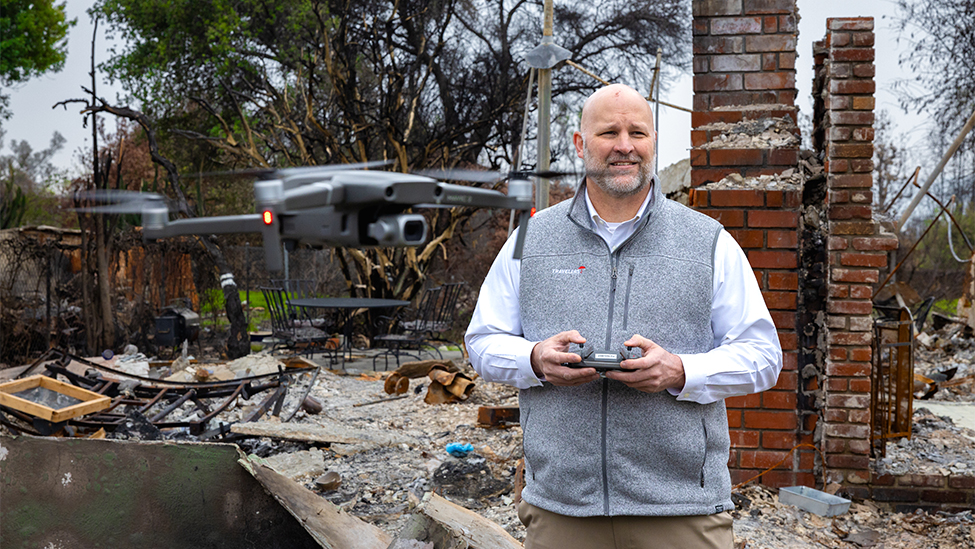
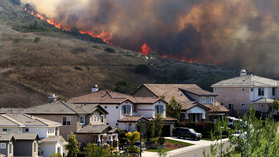
- Combining aerial imaging and AI learning to detect wildfire and wind losses. Our geospatial platforms use photographic images taken from aircraft equipped with market-leading aerial capture systems. Pre-loss imagery is collected continually for virtually all of our insured locations. This “blue-sky” imagery can be compared to post-event (“gray-sky”) imagery to assist us in detecting and evaluating loss. Over the past decade, we collected post-event aerial imagery covering more than 84,000 square miles in connection with weather events. Leveraging the post-event imagery of damaged and undamaged homes, we use industry-leading AI and machine learning to quickly assess the damage sustained, which helps inform our operational response. The Travelers Wildfire Loss Detector tool helps us assess which properties are total losses after a wildfire event, while the Travelers Wind Damage Detector tool allows us to evaluate the severity of damage sustained in wind events. With these powerful tools, we can more quickly identify customers with the most significant damage so we can begin the claim process – often before we have access to the area – thereby allowing our customers to begin recovering and rebuilding their properties sooner. Our agent and broker portal includes these tools so our distribution partners can better assist customers after a disaster as well. This video provides more detail on our geospatial capabilities.
- In January 2025, this capability allowed us to support our customers affected by the devastating wildfires in Pacific Palisades and Altadena, California. Those fires destroyed homes and businesses across multiple communities on Tuesday and Wednesday, January 7 and 8. By that Friday, we were able to confirm the locations that had suffered a total loss. On that Saturday, we then made outbound calls to those customers who had not yet reported a claim to help them report the loss and to initiate the claim settlement process. Our team’s prompt actions allowed us to offer advance payments, long-term housing and certainty around the settlement process to our policyholders impacted by the fires. This video highlights the extraordinary resilience of our Claim team and customers in California after facing one of the most significant catastrophe events in the region’s history.
- Using smartphones for quicker, safer claim inspections. Thanks to innovative virtual inspection and measurement technology, we are able to transform smartphone photos of a property into a precise 3D model so that our Claim professionals can more quickly and accurately inspect and estimate property damage. We are often able to evaluate the damage with information our policyholders provide to us, without having to schedule an on-site inspection. We use similar technology to virtually handle auto losses after large CAT events where thousands of cars may be damaged. With the help of these cutting-edge technologies, we are creating a faster and easier claim process for our customers and a safer environment for our employees.
We also gather data from controlled tests to improve prevention and preparation. For example, Travelers supports the Insurance Institute for Business & Home Safety (IBHS), which has a one-of-a-kind controlled research facility that can generate hurricane-force winds, hail, and wind-driven rain and embers. The studies conducted in this facility allow IBHS and supporting members such as Travelers to study the impacts of weather events in real-world scenarios; they also allow us to analyze the results to better respond to events and protect our customers and their assets. For more information on IBHS and the ongoing work Travelers supports, see our illustrative initiative regarding IBHS.
More about disaster preparedness & response
Approach
We take a holistic approach to managing our company’s exposure to disasters and to helping our customers prepare for, respond to and recover from catastrophic events.
Partner in preparedness
We offer a range of resources that help our customers and the public prepare for disasters.
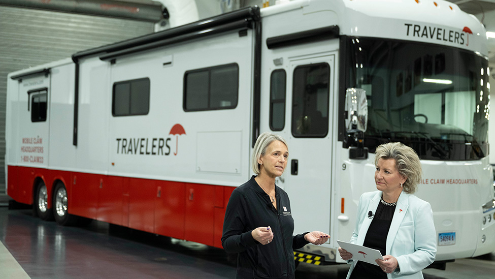
Dedicated catastrophe response resources
Our sustained investment in innovative catastrophe response strategies sets Travelers apart from our peers.
Customer outcomes
Despite the added logistical difficulties inherent in catastrophe (CAT) response, our CAT claim performance consistently meets or exceeds our internal benchmarks for claim handling.
Illustrative initiatives
Disaster Response
Travelers Responds to the Palisades and Eaton Fires
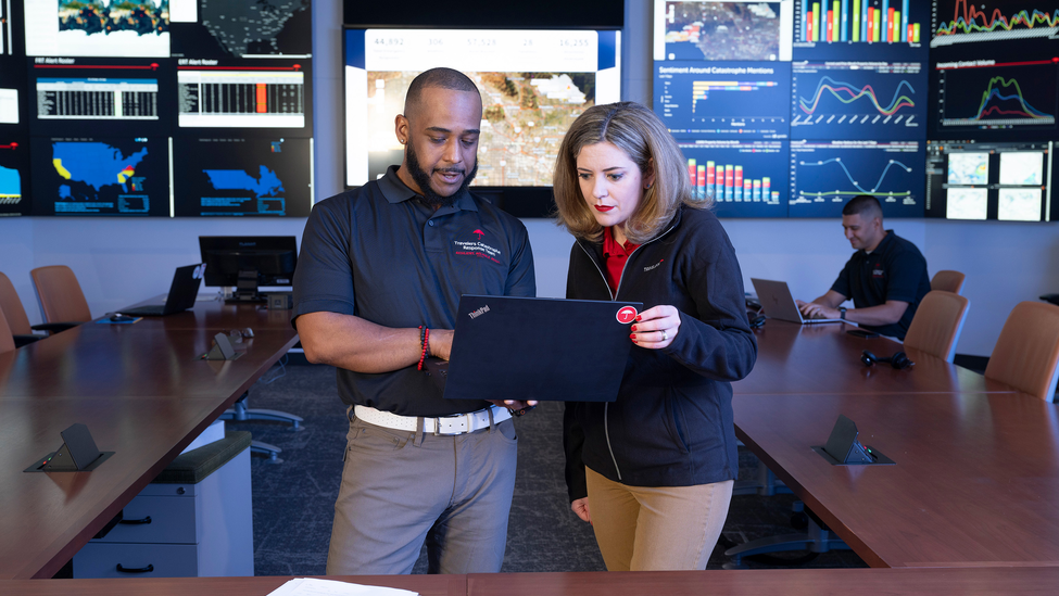
National Catastrophe Center
Catastrophe Planning and Response
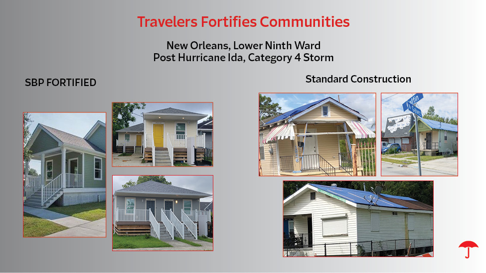
Travelers Fortifies Communities
Building Strong, Resilient Communities
Wildfire Defense Services
Protecting Our Customers from Increased Wildfire Risk
IBHS Sponsorship
Supporting Research in Severe Weather Readiness and Response
Travelers Institute®
Thought Leadership on Disaster Preparedness